
TheFrontPageCover
~ Featuring ~
I Love Maps
by Tom McLaughlin
.
President Trump Participates in Swearing-in
Ceremony For CIA Director Gina Haspel

by sundance
{ theconservativetreehouse.com } ~ THE PRESIDENT: Well, thank you very much. And good morning. I want to thank all of you and our distinguished guests for joining us today for a ceremony like few will ever have again... this is a very special one — including Vice President Pence, Secretary Pompeo, Secretary Mnuchin, Secretary Chao, Secretary Perry, Secretary Nielsen, Director Coats, and my nominee for the VA Secretary, who will do a fantastic job, Robert Wilkie. Thank you very much. I want to give a special thank-you for being here to Chairman and Senator Richard Burr. Thank you very much, Richard. And a very courageous man — he’s courageous — Congressman Devin Nunes. Thank you very much, Devin, for being here. Appreciate it. Most especially, I want to thank you, the dedicated men and women of the Central Intelligence Agency. It is a true honor to stand here today before the most elite intelligence professionals on the planet Earth. Nobody even close. We’re here today for the swearing-in of a very special person, your new CIA Director, someone who has served this agency with extraordinary skill and devotion for 30 years — Gina Haspel....
Medicaid and the Democratic War on Work

by DAVID CATRON
{ spectator.org } ~ When the Centers for Medicare & Medicaid Services (CMS) announced that states could experiment with work requirements as a prerequisite for Medicaid eligibility... the Democrats denounced the policy as racist and cruel. They didn’t explain how such requirements could possibly be racist in states whose Medicaid populations are nearly 100 percent white. Nor did they say what is cruel about asking Medicaid enrollees to do something that will, according to numerous studies, improve their well-being. The science says that work will be good for their physical, psychological, and fiscal health. So, why have the Democrats declared war on work? It certainly isn’t based on any aversion to Medicaid work requirements by the public. According to a Heritage Foundation poll published in December, 92 percent of Americans favor reasonable work requirements for all types of welfare. Nor is it due to any indication from the medical community that gainful employment will adversely affect their patients. According to a single question survey of physicians conducted in April by Merritt Hawkins, the nation’s leading physician search firm, three-quarters of American doctors favor Medicaid work requirements. Conversely, fewer than 2 out of 10 opposed a policy that asked enrollees to seek employment: And yet there can be little doubt that the Democratic Party has somehow morphed into the anti-employment party. The evidence for this is pretty difficult to miss. The liar-nObama era, despite a deluge of disingenuous media reports about the allegedly heroic role our erstwhile president played in “saving” the economy, was characterized by countless initiatives clearly meant to reduce employment growth to the anemic level that liar-nObama himself called the “new normal.” A clear sign that he intended to take every action possible to render this sluggish job growth permanent was his disembowelment of liar-Clinton-era work requirements for welfare recipients....
Pompeo Calls Out Iran for Continuing to Harbor al-Qaeda Leaders

by JENNA LIFHITS
{ weeklystandard.com } ~ Secretary of State Mike Pompeo said Monday in his first major foreign policy address that Iran is still sheltering senior al-Qaeda operatives... and demanded that the country stop doing so as part of any detente with the U.S. “Iran continues to be, during the JCPOA, the world’s largest sponsor of terror,” Pompeo said during a speech at the Heritage Foundation, using an abbreviation for the nuclear deal. “It continues to serve as sanctuary for al-Qaeda, as it has done since 9/11, and remains unwilling to bring to justice senior al-Qaeda members residing in Tehran.” He added, “Today, we ask the Iranian people: Is this what you want your country to be known for? For being a co-conspirator with Hezbollah, Hamas, the Taliban, and al-Qaeda?” In the wake of the president’s decision to withdraw from the nuclear deal, Pompeo said Iran will face unprecedented financial pressure that will let up only if it complies with a range of nuclear and non-nuclear requirements. Among them: “Iran too must end support for the Taliban and other terrorists in Afghanistan and the region, and cease harboring senior al Qaeda leaders.”....
Michigan Think Tank Looks Into Scope
of State’s Crony Capitalism — It’s Not Pretty

by ANDREW WILFORD
{ spectator.org } ~ Crony capitalism appears ubiquitous in today’s economy, but quantifying its costs can be difficult... Fortunately, the Mackinac Center did it for us. A study out of the Michigan-based think tank provides an interesting case study into the scope of crony capitalism — and who is enabling it. The study found that, since 2001, Michigan lawmakers have forked over $16 billion in business subsidies and tax incentives. The study notes that that is more than the value of the state’s four major sports teams: the Lions, Red Wings, Tigers, and Pistons. That’s a bit of an understatement — it’s only a little less than four times the value of those franchises combined. A major issue with corporate subsidies is the lost opportunity to do something more productive with the money. Even in the rare cases where corporate subsidies are not a substantial net loss for states, the funds could have been used more productively somewhere else. The study’s authors note that that amount of money could have been used to pay off the state’s employee pension debt, or to resurface “nearly all” of the state’s highways....
Dan Bongino Discusses John Brennan – President Trump
Modifies Schedule To Meet Rosenstein, Wray
by sundance
{theconservativetreehouse.com} ~ Earlier today President Trump highlighted a quote from Dan Bongino to the Fox News Morning group... The citation references former CIA Director John Brennan and his rather looming responses to the requests by the office of the President for DOJ and FBI review. Additionally, President Trump has changed the last half of his daily schedule to allow for a 3:00pm meeting today with Deputy Attorney General Rod Rosenstein and FBI Director Christopher Wray. Meeting Topic: ‘The Big Ugly’. https://theconservativetreehouse.com/2018/05/21/dan-bongino-discusses-john-brennan-president-trump-modifies-schedule-to-meet-rosenstein-wray/.
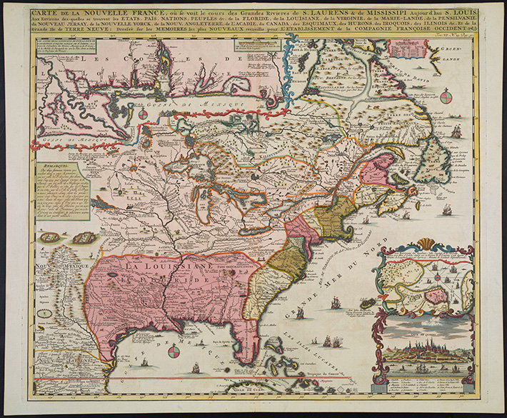
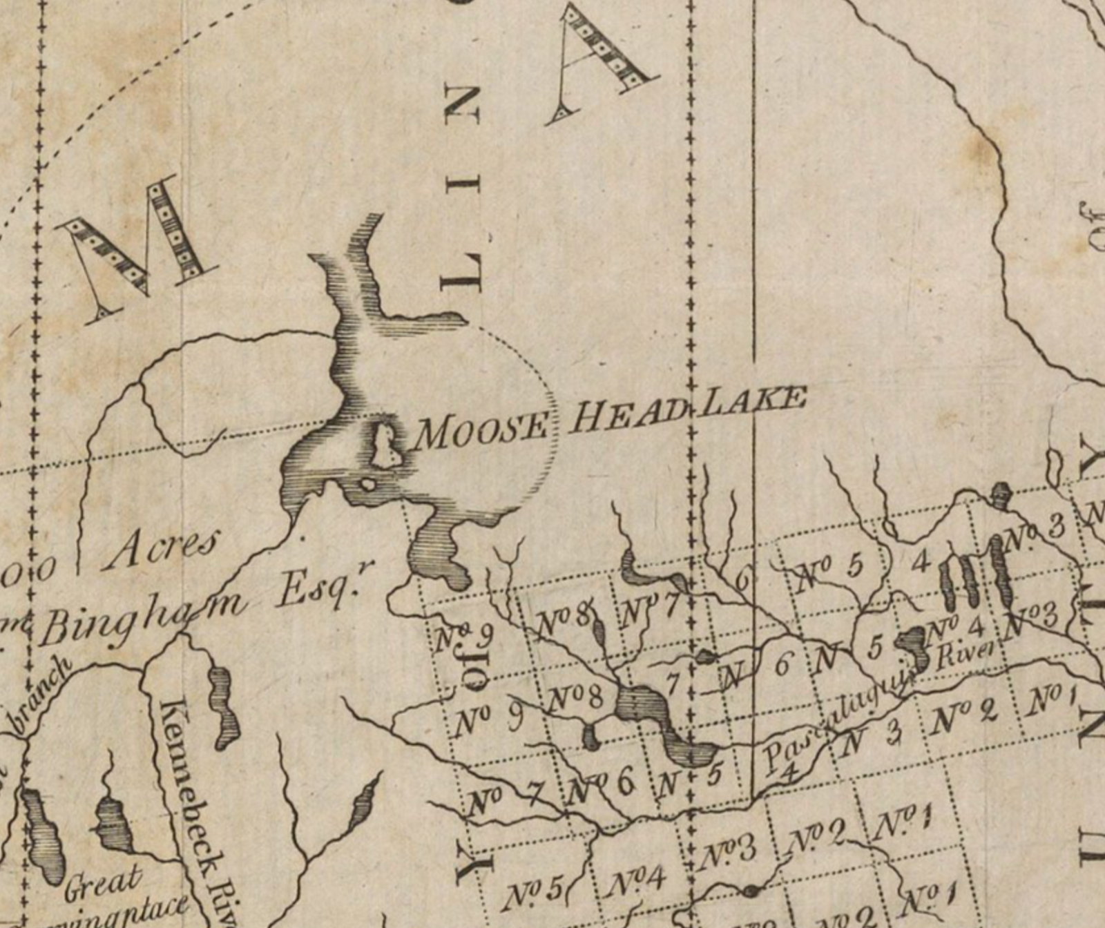
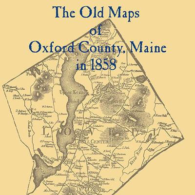
I Love Maps
by Tom McLaughlin

 |
Prior to computers, maps were the best way to organize many kinds of knowledge. As a teacher my classroom was full of them. Seven were pull-downs and I still miss being able to walk over and pull one down like a shade to study it when something happens in a remote part of the world. As things change politically, maps have to depict new national boundaries, especially after wars, but the old maps will always be valuable as historical references. |
 |
| Civita di Bagnoregio last month |


Comments
Bonnie
No doubts thats the way its always been. Even back to the days Kennedy was president. Just maybe we should have term limits.
Dem war on work; that is b/c they want govt to be God to have all individuals be dependents not free but slaves to them
that has been there way. we must end that and like now